Natural Resources Wales
Type of resources
Available actions
Topics
Keywords
Contact for the resource
Provided by
Years
Formats
Representation types
Update frequencies
status
Scale 1:
-
An atlas of marine species for Pembrokeshire including flora and fauna, intertidal and sublittoral data, funded by the Counytryside Council for Wales (CCW). It is a collation of data from various CCW and third party sources (both published and unpublished) that cover Pembrokeshire, held within 79 surveys. This is a historical collation which is not being updated. The data includes all records from the Dale Fort Marine Fauna survey plus additional data from subsequent and prior surveys. Data that are included in the MNCR database have been excluded from this dataset to avoid duplication.
-
This dataset comprises of ad-hoc records of species recorded by NRW staff outside of the methodology of dedicated research and monitoring surveys. Although any species may be recorded, records are usually made where they are likely to be of interest, such as, rare and scarce species and species outside of their normal range, species that have not previously been recorded in a site etc.
-
This dataset comprised marine surveys undertaken by the Natural Resources Wales (and previously Countryside Council for Wales) for Marine alien and non-native species, currently held in Marine Recorder. The surveys represent ongoing non-native monitoring, sightings and ad-hoc records of invasive and non-native species supplied to NRW or noted outside of other research and monitoring work.
-
This dataset is comprised of marine benthic surveys created by Natural Resources Wales' (and previously the Countryside Council for Wales') technical support (research and monitoring) contracts since 1993. The surveys focus on benthic habitats (often referred to as 'biotopes') in intertidal, inshore (typically within 3nm) and subtidal areas. These surveys include the capture of many species records. Only the species records are available on the NBN Gateway. Some of the surveys were originally stored in the MNCR (Marine Nature Conservation Review) database created by JNCC but then transfered to CCW. (However, none were carried out as part of JNCC's MNCR officical survey programme). Original copies of all the surveys are now held in NRW's Marine Recorder database.
-
This dataset consists of surveys entered by Natural Resources Wales(NRW).
-
Skomer MNR was designated in 1990. This dataset contains the results of a range of projects developed by Skomer Marine Monitoring Team to monitor the health of the reserve and investigate the relevant aspects of the species life histories for baseline information. Large scale surveys developed in the 1970's and 1980's provided the foundation for the monitoring.
-
This datasets contains species recorded as part of CCW's Phase 1 Intertidal habitat mapping survey. The Intertidal mapping took place between 1996 and 2005. All work was carried out by an in-house survey team.
-
This dataset includes the survey data that were commissioned and collected by Countryside Council for Wales.
-
Marine biological surveys of seabed and shore habitats in four areas exposed to strong tidal currents around southwest and northwest Wales, made in summer 2002 and 2003.
-

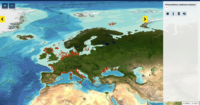
This product displays the stations present in EMODnet validated dataset where fluoranthene levels have been measured in sediment. EMODnet Chemistry has included the gathering of contaminants data since the beginning of the project in 2009. For the maps for EMODnet Chemistry Phase III, it was requested to plot data per matrix (water,sediment, biota), per biological entity and per chemical substance. The series of relevant map products have been developed according to the criteria D8C1 of the MSFD Directive, specifically focusing on the requirements under the new Commission Decision 2017/848 (17th May 2017). The Commission Decision points to relevant threshold values that are specified in the WFD, as well as relating how these contaminants should be expressed (units and matrix etc.) through the related Directives i.e. Priority substances for Water. EU EQS Directive does not fix any threshold values in sediments. On the contrary Regional Sea Conventions provide some of them, and these values have been taken into account for the development of the visualization products. To produce the maps the following process has been followed: 1. Data collection through SeaDataNet standards (CDI+ODV) 2. Harvesting, harmonization, validation and P01 code decomposition of data 3. SQL query on data sets from point 2 4. Production of map with each point representing at least one record that match the criteria The harmonization of all the data has been the most challenging task considering the heterogeneity of the data sources, sampling protocols. Preliminary processing were necessary to harmonize all the data : • For water: contaminants in the dissolved phase; • For sediment: data on total sediment (regardless of size class) or size class < 2000 μm • For biota: contaminant data will focus on molluscs, on fish (only in the muscle), and on crustaceans • Exclusion of data values equal to 0
 EMODnet Product Catalogue